Portions of the central U.S. are bracing for potentially severe weather this week as storms move across the area. For portions of Nebraska and Iowa, it was an active weather weekend, including multiple tornado watches and warnings issued by the National Weather Service.The NWS said a confirmed tornado was located over Glenwood, Nebraska, around 9 p.m. Sunday.Cellphone video also captured a possible tornado in Palmer, Nebraska on Sunday.See storm footage in the video player aboveThe storms knocked out power for thousands of customers in Nebraska and Iowa. More than 2,500 remained without power late Monday morning.Video above: Cellphone video captures a massive tornado in Palmer, Nebraska Video above: Storm damage near Rockwell City, IowaVideo above: Apparent tornado east of Algona, IowaSister station KETV’s Storm Prediction Center has areas from Omaha to Lincoln and to the south and east in an enhanced zone for severe activity for Monday. Farther to the south, a flood watch is now in effect through Tuesday morning across the Kansas City area as multiple rounds of heavy rain and severe thunderstorms threaten the region over the next 24 hours.The National Weather Service expanded the watch overnight to include the entire Kansas City metro and much of eastern Kansas and northern Missouri.Additionally, Oklahoma is expected to see more days of severe weather threats beginning Monday. An enhanced risk has been issued in northern Oklahoma. If storms do develop, this area could see significant storms with an elevated tornado threat.
Portions of the central U.S. are bracing for potentially severe weather this week as storms move across the area.
For portions of Nebraska and Iowa, it was an active weather weekend, including multiple tornado watches and warnings issued by the National Weather Service.
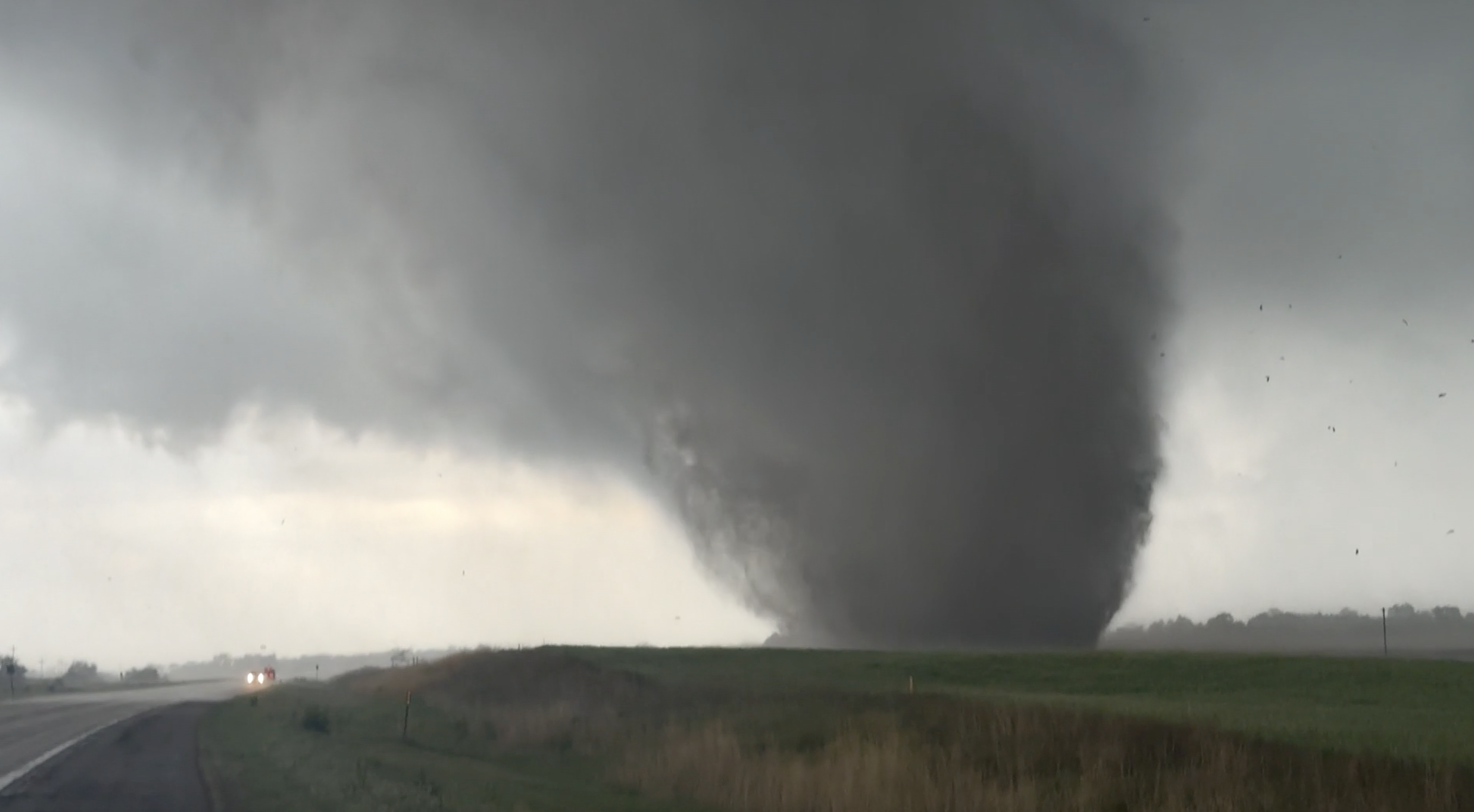
The NWS said a confirmed tornado was located over Glenwood, Nebraska, around 9 p.m. Sunday.
Cellphone video also captured a possible tornado in Palmer, Nebraska on Sunday.
See storm footage in the video player above
The storms knocked out power for thousands of customers in Nebraska and Iowa. More than 2,500 remained without power late Monday morning.
Video above: Cellphone video captures a massive tornado in Palmer, Nebraska
Video above: Storm damage near Rockwell City, Iowa
Video above: Apparent tornado east of Algona, Iowa
Sister station KETV’s Storm Prediction Center has areas from Omaha to Lincoln and to the south and east in an enhanced zone for severe activity for Monday.
Farther to the south, a flood watch is now in effect through Tuesday morning across the Kansas City area as multiple rounds of heavy rain and severe thunderstorms threaten the region over the next 24 hours.
The National Weather Service expanded the watch overnight to include the entire Kansas City metro and much of eastern Kansas and northern Missouri.
Additionally, Oklahoma is expected to see more days of severe weather threats beginning Monday. An enhanced risk has been issued in northern Oklahoma. If storms do develop, this area could see significant storms with an elevated tornado threat.